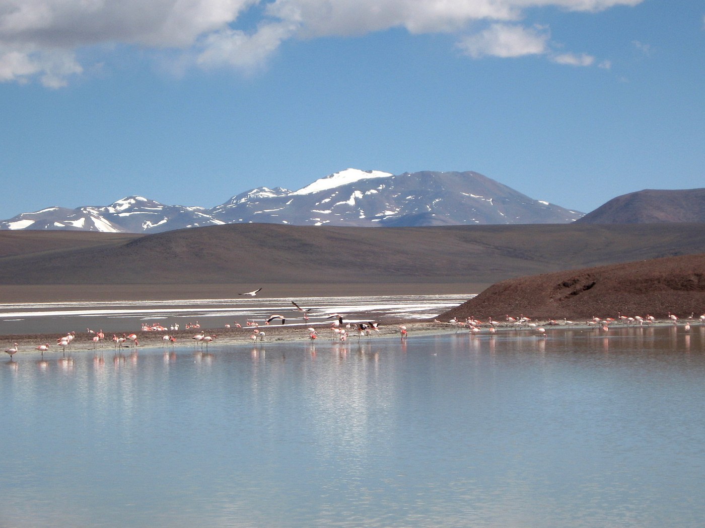

A pink line across the water may be the first sign of flamingos, but it does not by itself explain which species are present or why they are there. High Andean wetlands belong to a changing landscape, with water, shorelines, and resources that do not remain identical throughout the year. Watching birds in that setting means looking at the lagoon as well as the flock and accepting that a visit may differ greatly from a brochure image.
Changing water and different species
Pozuelos in Jujuy helps explain that relationship. Official documentation describes a shallow lagoon whose extent can vary substantially. Available water changes the area of its habitats, and the shoreline visible from an access point is not a permanent boundary. A place where birds were once seen nearby may be far from the water on another visit. That does not justify crossing unauthorized ground to regain the earlier viewing distance.
Three flamingo species are recorded at Pozuelos. A pink flock cannot automatically be described as entirely Andean flamingos. Identification requires observable features and a suitable guide, while allowing for age, distance, and light. If the details cannot be distinguished, recording flamingos without assigning a species is valid. The photograph accompanying this article shows birds at Laguna Brava in La Rioja and does not claim to identify every individual.
Birds connecting landscapes
Movement also expands the map. Argentina's National Parks Administration has documented Andean flamingos beyond high-elevation wetlands, including movements toward lowland areas and breeding records at Ansenuza. “High Andean” therefore does not mean that every individual always stays at altitude. Interpreting an observation requires its date and a defensible species identification, not simply a mountainous-looking background.
This mobility helps explain the value of coordinated observation across several wetlands. A local count is a snapshot, not an automatic estimate of the entire population. If birds disappear from a familiar location, one visit cannot establish that they have died or permanently left the region. Movements and changes in distribution may require specialist monitoring to understand.
Watching without displacing
During an outing, use the permitted observation point indicated by staff or a guide and bring binoculars or a telescope. Appropriate distance is not determined by how much of a phone screen a bird fills. If birds move away or interrupt their activity as you advance, withdraw and follow local instructions. Never use a drone or an approach from another direction to make them take flight.
Breeding areas require particular restraint. Do not search for nests independently or publish a route leading to them. The absence of a visible barrier does not make the entire shoreline accessible. In open terrain, a person may appear distant from the road while still having entered a sensitive area for the birds.
Record the date, authorized observation location, and level of confidence in the identification. You can describe feeding, resting, or movement without imposing an explanation you did not observe. An outing without a close photograph can still reveal relationships among water, distance, and mobility. Much of the interest of these wetlands lies in life that does not organize itself around the visitor, and in learning to recognize that independence rather than trying to overcome it.