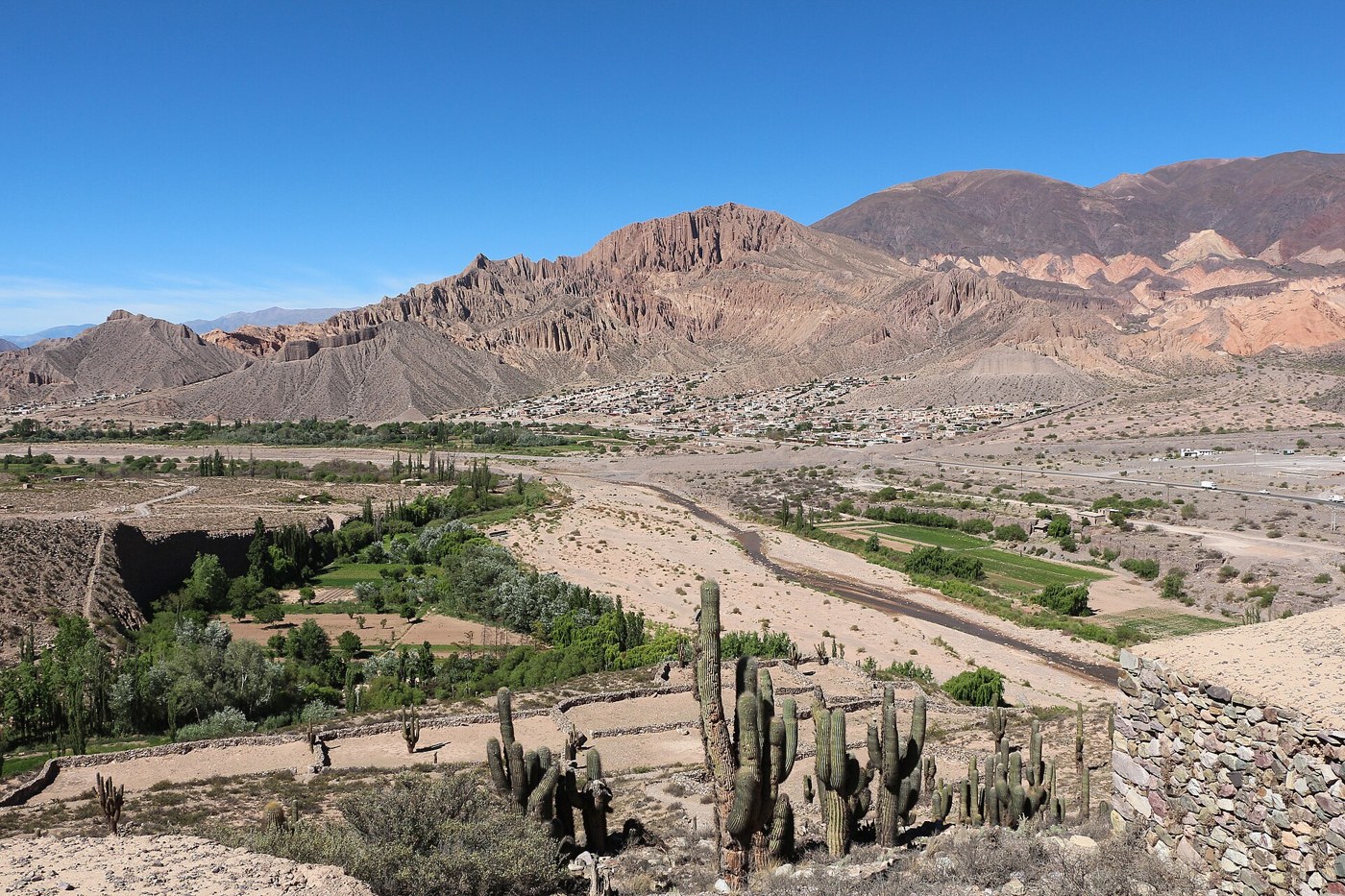

The Quebrada de Humahuaca cannot be fully understood as a sequence of colorful hills. In this Jujuy valley, the Río Grande, cultivated ground, settlements, and routes form a cultural landscape. UNESCO inscribed it on the World Heritage List in 2003. That recognition concerns relationships between people and territory over time. It does not turn every corner into a setting prepared for visitors, or remove the present-day needs of the people who live there.
Follow the corridor
Before choosing stops, look at a map showing the river and principal towns. The corridor helps explain why people, goods, and ideas moved through this landscape. It also makes clear that a seemingly short journey can involve different access roads, town crossings, and time spent at each destination. Distinguish the main valley from roads climbing to viewpoints or entering side valleys. These are different experiences, and conditions on one section cannot establish conditions on every other road. A map is a way to ask better questions, rather than a promise about travel time.
Connect settlement and terrain
Instead of looking only for a hillside's strongest colors, observe how a settlement relates to its terrain. The positions of homes, fields, and river crossings raise questions that an isolated photograph cannot answer. A local museum or an appropriately authorized guide can contribute names, dates, and perspectives. The most useful explanation is not necessarily the one that reduces the whole valley to a single legend. Communities have different histories and experiences, while archaeological interpretations need their own context. Leave room for more than one account of a place.
Heritage with residents
Heritage status does not make every space public. A visible path may cross working land or a site with particular significance for a community. Ask before leaving an established visitor route, and respect a refusal without trying to negotiate a photograph. In a plaza or market, taking a general view is not the same as having permission to move a camera close to someone. Asking, listening, and accepting boundaries are part of understanding a place rather than interruptions to sightseeing.
Compare without collecting stops
Choosing fewer towns creates opportunities to compare without turning the trip into a collection of stops. You might devote one visit to the relationship between a settlement and its surroundings, another to an interpreted collection, and a third to an activity offered by residents. That selection still needs time for meals, transportation, and rest. A useful reading of the Quebrada may ultimately come from modest details: a field beside the riverbed, a street used by neighbors, or an explanation that changes how you look at the next hillside.