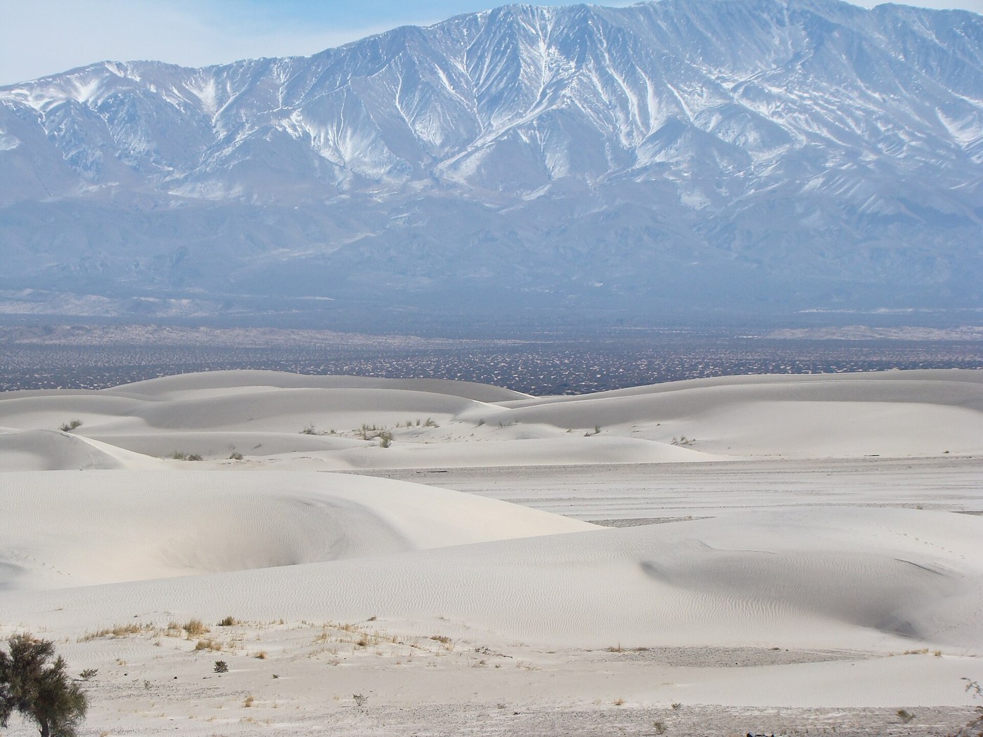

The Tatón dunes in western Catamarca offer a landscape whose relief is not built only from solid rock. Sand creates surfaces that look simple from a distance and become complex at closer range: small ripples across extensive slopes, crests hiding further crests, and shadows that change the apparent height. The visit becomes more rewarding when these differences in scale replace the search for a single photographic position.
Processes visible at different scales
A dune forms when wind transports sand and deposits it under conditions that allow accumulation. The US National Park Service explains the general processes: sediment supply, wind strength and direction, obstacles, and vegetation all matter. This framework helps interpret Tatón, but without local research it cannot establish which rock supplied every grain or how old a particular shape is.
Notice the difference between a small ripple and the outline of an entire dune. Both belong to the same landscape, but they do not necessarily represent the same formation period or respond identically to a change in wind. A crest that seems fixed throughout a visit can still belong to a dynamic system. Dynamic does not mean that everything must visibly move all the time.
In many dune fields, gentler slopes and steeper faces reflect sand transport and deposition. Do not turn that general principle into an infallible compass: forms can preserve the influence of winds from different directions. Compare several surfaces before drawing a conclusion. If wind lifts sand during the visit, protect your eyes and equipment rather than treating the scene as a reason to push farther ahead.
Reading distances and choosing a route
Scale can be deceptive because familiar reference points are scarce. A distant person may seem close, and a visible crest may conceal a substantial hollow. Elevation above sea level is also different from a dune's height measured from its base. This distinction helps when reading figures and record claims in tourism descriptions. The landscape's extent does not need a ranking to be interesting.
Tatón belongs to the wider Fiambalá and Tinogasta area, but a track on a map does not confirm that any vehicle can use it or that driving on the sand is permitted. Check current access arrangements and choose an authorized route. Existing tire marks are not permission to create new ones; patches of vegetation deserve particular care even when they look small against the sandy expanse.
Before walking, agree with the outing organizer on the limit of the route and a clear reference for returning. Climbing sand requires a different effort from walking on firm ground. Allow enough energy for the return and do not assume that descending another face brings you to the same place. A short walk can provide ample changes of perspective without crossing every visible crest.
Photographing the forms
For photographs, combine a broad view with a detail of ripples taken from the permitted route. Note the light direction and watch how shadows explain the forms. Avoid removing all vegetation or human presence from the story to present the place as an absolute void. Tatón is a landscape to interpret, rather than an unlimited surface available for any activity.